More About Karakoram Highway Hunza:
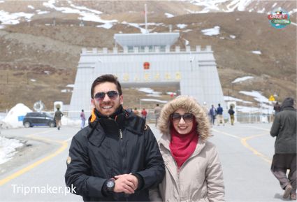
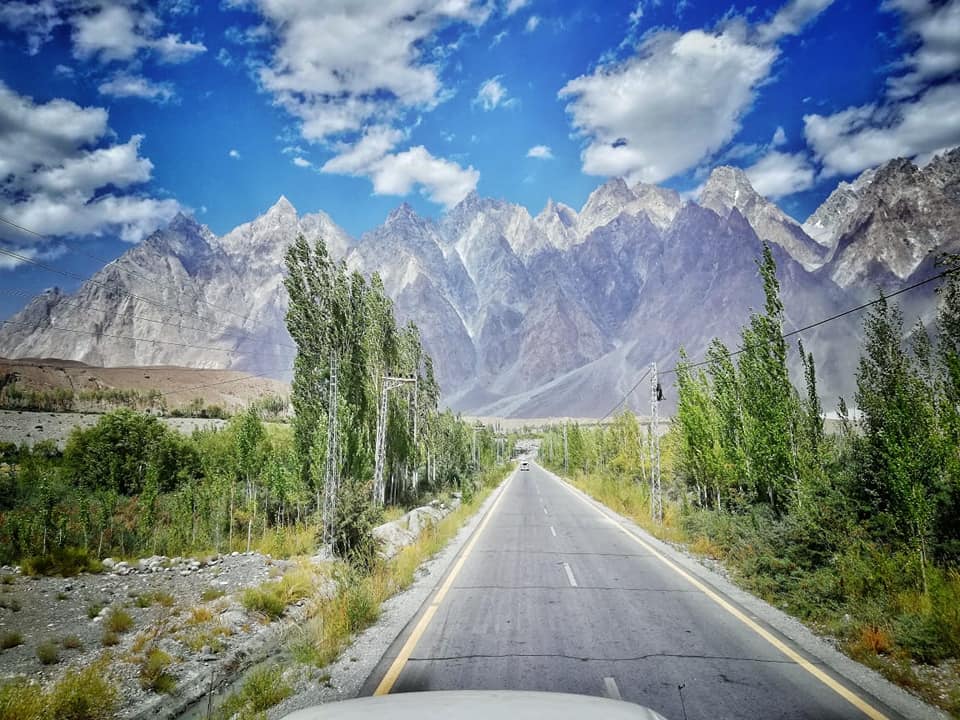
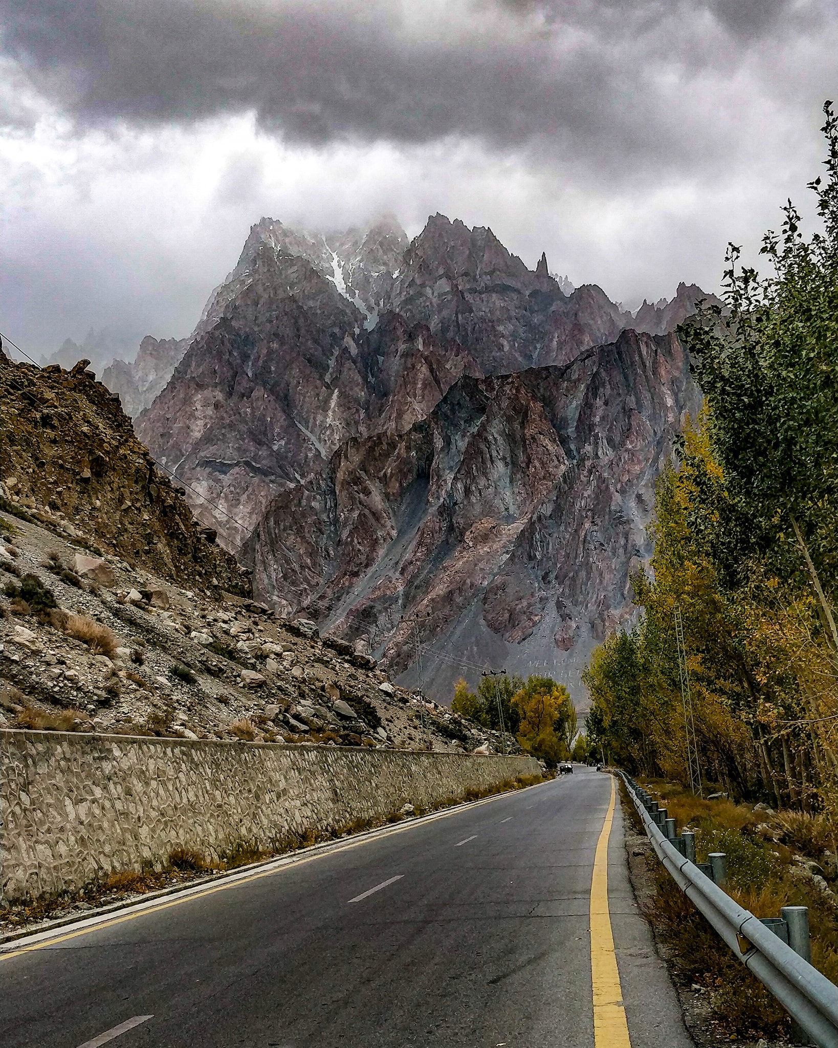
The Karakoram Highway (Urdu: شاہراہ قراقرم, Śāhirāh-i Qarāquram), commonly referred to as the KKH, National Highway 35 (Urdu: قومی شاہراہ ۳۵), N-35, and the China–Pakistan Friendship Highway, is a national roadway measuring 1,300 km (810 mi) that stretches from Hasan Abdal in the Punjab province of Pakistan to the Khunjerab Pass in Gilgit-Baltistan, where it intersects with China and transforms into China National Highway 314. This highway links the provinces of Punjab and Khyber Pakhtunkhwa, along with Gilgit-Baltistan, to China’s Xinjiang Uyghur Autonomous Region. It is a favored tourist destination and is considered one of the tallest paved roads globally, traversing through the Karakoram mountain range, reaching its highest point at 4,714 m (15,466 ft) near Khunjerab Pass, located at coordinates 36°51′00″N 75°25′40″E. Due to its elevated terrain and the challenging conditions required for its construction, it is often dubbed the Eighth Wonder of the World. Furthermore, the highway forms part of the Asian Highway AH4.
The Karakoram Highway, also known in China as the Friendship Highway, was constructed collaboratively by the governments of China and Pakistan. Construction commenced in 1962, concluded in 1979, and was opened to the public in 1986. Initially, Pakistan preferred a route through Mintaka Pass; however, in 1966, China suggested the steeper Khunjerab Pass due to concerns that Mintaka would be more vulnerable to airstrikes. Approximately 810 Pakistani workers and around 200 Chinese workers lost their lives, primarily due to landslides and falls, during the highway’s construction. Over 140 Chinese workers who died during the building process are interred in the Chinese cemetery in Gilgit. The path of the KKH follows one of the numerous routes of the ancient Silk Road.
On the Pakistani side, the road was developed by FWO (Frontier Works Organisation) with assistance from the Pakistan Army Corps of Engineers. The Engineer-in-Chief’s Branch of the Pakistani Army undertook a project documenting the history of the highway. A two-volume work titled History of Karakoram Highway was authored by Brigadier (Retired) Muhammad Mumtaz Khalid. The first volume examines the region’s land and population, prehistoric communication systems in the Northern Areas, the necessity for an all-weather road connection with Gilgit, and the construction of the Indus Valley Road. The second volume recounts events leading to the transformation of the Indus Valley Road into the Karakoram Highway, challenges faced during its construction, and the involvement of both the Pakistan Army Corps of Engineers and their Chinese counterparts in the building process.
The highway runs approximately 1,300 km (810 mi), linking the Gilgit–Baltistan region with the ancient Silk Road, from Kashgar, a city located in China’s Xinjiang region, to Abbottabad in Pakistan. An extension of the highway leading southwest from Abbottabad takes the form of the N-35 highway, which connects with the Grand Trunk Road, N-5, at Hasan Abdal, Pakistan. The highway traverses the collision zone between the Eurasian Plate and the Indian Plate, where China, Tajikistan, Afghanistan, and Pakistan come within 250 km (160 mi) of each other. Due to the highly sensitive situation of the Kashmir conflict between India and Pakistan, the Karakoram Highway holds strategic and military significance for these nations, especially Pakistan and China.
On 30 June 2006, a memorandum of understanding was established between the Pakistani National Highway Authority (NHA) and China’s State-owned Assets Supervision and Administration Commission (SASAC) to refurbish and upgrade the Karakoram Highway. SASAC indicated that the highway’s width would be widened from 10 to 30 m (33 to 98 ft), and its transport capacity would be tripled. Additionally, the newly enhanced road will be designed to handle heavy loads and extreme weather conditions effectively.
Plans are in place for China and Pakistan to connect the Karakoram Highway to the southern port of Gwadar in Balochistan through the Gwadar-Dalbandin railway, which is financed by Chinese assistance and extends to Rawalpindi. On 4 January 2010, the KKH was closed in the Hunza Valley, halting through traffic to China except via small boats. A significant landslide 15 km (9.3 mi) upstream from Hunza’s capital of Karimabad resulted in the formation of the unstable Attabad Lake, which reached a length of 22 km (14 mi) and a depth of over 100 m (330 ft) by early June 2010 when it finally began to overflow the landslide dam. This landslide led to the destruction of parts of the villages and caused numerous fatalities. The resulting lake displaced thousands and submerged more than 20 km (12 mi) of the KKH, including the 310 m (1,020 ft) long bridge located 4 km (2.5 mi) south of Gulmit.
It remains uncertain whether the lake, which expanded to 27 km (17 mi) in length in 2011, will eventually drain. Goods destined for northern areas were transported over the lake using small boats, which were then transferred to trucks at the opposite end. In July 2012, Pakistan began constructing a new route around the lake at a higher elevation.


